Charting errors
So having said that Amanu is where we expect, it's where the main charting application I use expects. Seen here, the tip of Amanu is at 17 55S 140 51W.
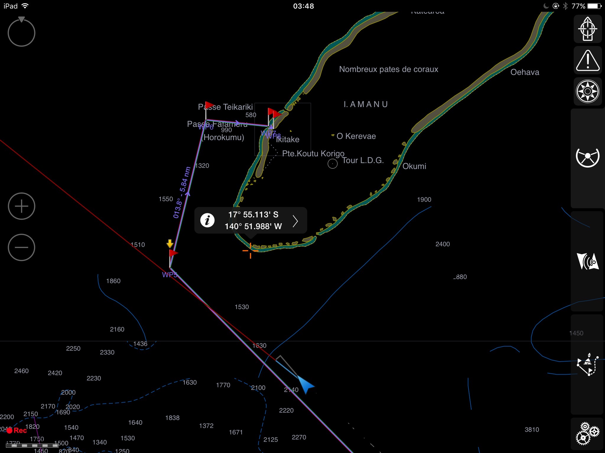 Indeed radar confirms that, but if I overlay the radar image on the Navionics charts, look what happens...
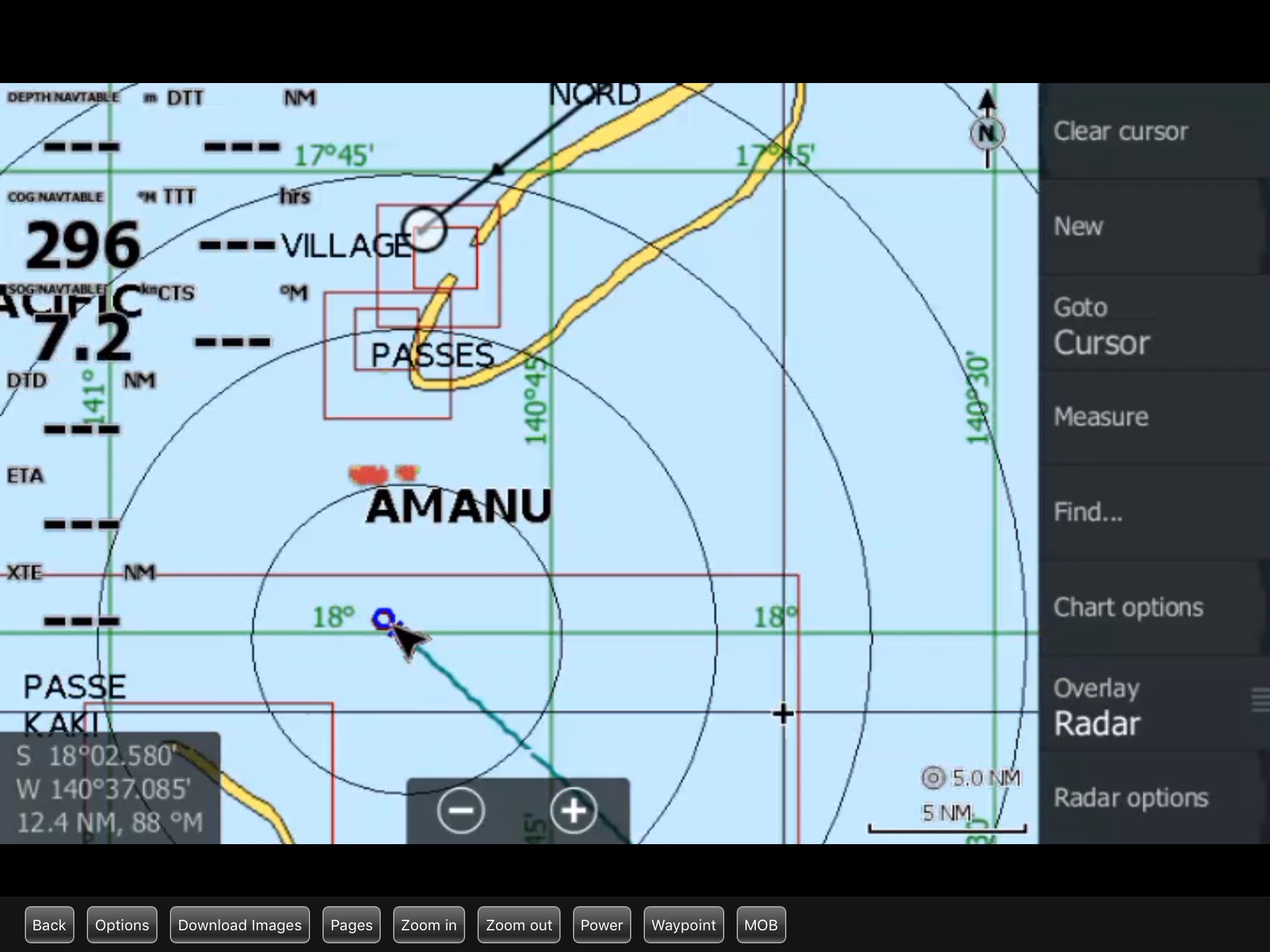 The red radar echo is at the right place, but the Navionics charts are way out!
Indeed radar confirms that, but if I overlay the radar image on the Navionics charts, look what happens...
The red radar echo is at the right place, but the Navionics charts are way out!